from 0 review
21 nights 22 days
Daily Tour
4-5 people
___


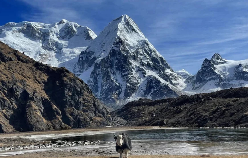
Mount Kanchenjunga lies on the eastern end of Nepal, near the border with Sikkim, a tiny Himalayan state in the north-east of India. Until the mid 1800s Kanchenjunga was thought to be the highest peak in the world but it is actually the third and it is a sacred peak which means mountaineers generally avoid standing on the summit itself.The main peak is 8586 metres, but the massif has four subsidiary summits exceeding 8000 metres, including Kanchenjunga West, also known as Yalung Kang (8,505m). Around the massif and seen on the trek are around twenty peaks more than 7000 metres high,the highest being Kambachen (7,903m) and also including legendary Jannu (7,710m) and Jongsong (7,483m), Kabru (7,353m), Tent Peak (7,365m) and the Twins (7,350m).
Five major glacial systems are found in this huge cluster of peaks and of these Zumu, Talung and Rathong flow into Sikkim while to the west, the Kanchenjunga and Yalung glaciers descned into the Tamor River of Nepal.The trek starts from the subtropical region of Taplejung, through beautiful temperate forests of maple, chestnut and birch trees. Even though farming is less productive in the hilly regions, you can still see terraced fields around these lower regions.Around Chitre you enter the upper temperate climatic vegetation of rhododendron, pine, firs, and orchids. Above here and across the Sele La (pass) towards Ghunsa begins the more subalpine and alpine climatic zone with shallow and dwarf shrubs and open meadows. Base Camp at 5143m is at the snowline with a rocky and icy landscape.
Snow Leopard, Himalayan Asian black bear and red pandas have been seen in this region although they are obviously shy and difficult to spot. Blood pheasant (below) and the Chestnut-breasted partridge are common bird species.
Why Choose Kanchenjunga Trek?

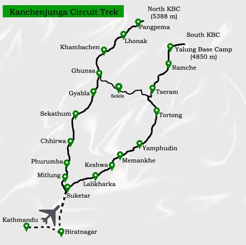
• Day 1: Kathmandu to Bhadrapur (Flight) to Ilam (Drive)
• Ilam – 1677 m / 5501 ft – 5 hrs
• Day 2: Ilam to Taplejung (Drive)
• Taplejung – 1820 m / 5971 ft – 5 hrs
• Day 3: Taplejung to Chirwa
• Chirwa – 1270 m / 4166 ft – 6 hrs
• Day 4: Chirwa to Lelep
• Lelep – 1860 m / 6102 ft – 7 hrs
• Day 5: Lelep to Amjilosa
• Amjilosa – 2510 m / 8234 ft – 5 hrs
• Day 6: Amjilosa to Gyabla
• Gyabla – 2730 m / 8956 ft – 4 hrs
• Day 7: Gyabla to Ghunsa
• Ghunsa – 3595 m / 11794 ft – 4 hrs
• Day 8: Acclimatization Day
• Ghunsa – 3595 m / 11794 ft – 4 hrs
• Day 9: Ghunsa to Kambachen
• Kambachen – 4100 m / 13451 ft – 4 hrs
• Day 10: Acclimatization Day
• Kambachen – 4100 m / 13451 ft – 4 hrs
• Day 11: Kambachen to Lhonak
• Lhonak – 4785 m / 15698 ft – 4 hrs
• Day 12: Day Trip to Kanchenjunga North Base Camp
• Lhonak – 4785 m / 15698 ft – 8 hrs
• Day 13: Lhonak to Ghunsa
• Ghunsa – 3595 m / 11794 ft – 7 hrs
• Day 14: Ghunsa to Sele Le
• Sele Le – 4390 m / 14402 ft – 5 hrs
• Day 15: Sele Le to Cheram
• Cheram – 3870 m / 12696 ft – 8 hrs
• Day 16: Day Trip to Kanchenjunga South Base Camp
• Cheram – 3870 m / 12696 ft – 6 hrs
• Day 17: Cheram to Torongding
• Torongding – 2080 m / 6824 ft – 4 hrs
• Day 18: Torongding to Yamphuding
• Yamphuding – 1980 m / 6496 ft – 8 hrs
• Day 19: Yamphuding to Khebang
• Khebang – 1910 m / 6266 ft – 4 hrs
• Day 20: Khebang to Khamdime
• Khamdime – 1500 m / 4921 ft – 4 hrs
• Day 21: Khamdime to Bhadrapur (Drive)
• Bhadrapur – 93 m / 305 ft – 10 hrs
• Day 22: Bhadrapur to Kathmandu (Flight)
• Kathmandu – 1300 m / 4265 ft – 50 minutes
Leave a reply